
Taipei Historical Maps
5.0

About Taipei Historical Maps
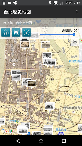
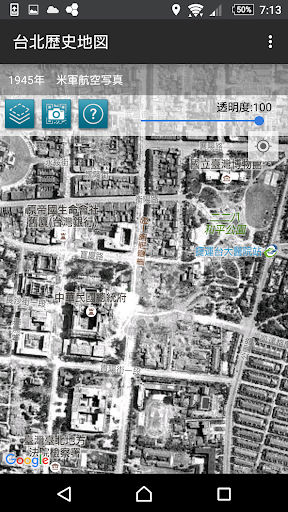
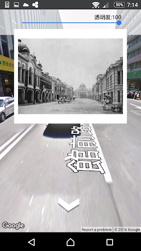
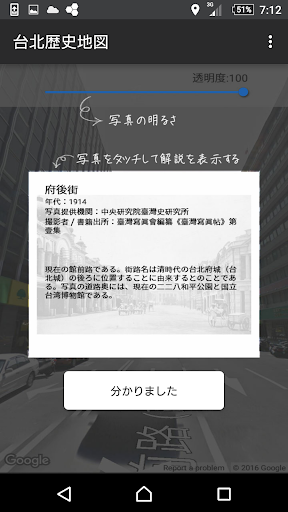
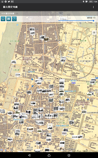
The Center for Geographic Information Systems (GIS) of the Research Center for Humanities and Social Sciences (RCHSS), Academia Sinica, has provided ten different street maps of Taipei dating from various time periods. All of the maps depict a general view of the area inside the city wall, Mengjia (Bangka) (present-day Wanhua District), and Dadaocheng. Other contributions include 131 old photographs from the collections of the Institute of Taiwan History at Academia Sinica, the National Diet Library of Japan, and Sunnygate Phototimes.
Disclaimer:
1. The maps provided are for reference purposes only; geographical accuracy is not guaranteed. The GIS is not responsible for any liabilities incurred by the use of this app.
2. The Google Maps and Street View functions may require an internet connection.
Video/Gameplay Trailer
Recent Updates - Version 2.0.1
- fix bug
Install On Your Mobile Device:


Install On Windows PC Or Mac: