
Trimble Penmap
3.1

About Trimble Penmap
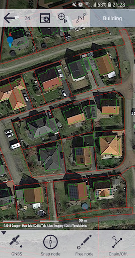
• GIS data question and editing
• Create Maps with Features and attributes
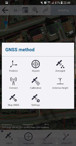
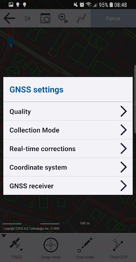
• Accurate location information using Trimble R-Series GNSS receivers
• Stake-out workflows
• Map-based visualization of data collection
• Point numbering and Coding
•
Trimble Penmap is a cloud mobile application and is part of the Trimble Connect Spatial platform which allows for ease of managing your field data collection projects.


Video/Gameplay Trailer
Recent Updates - Version 11.9.0
- * Fixes an issue recalculating RTX-measurements
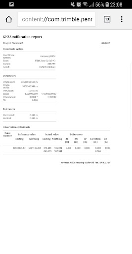
* CSV export: added an option “GNSS report” to the cloud service, which includes available information for GNSS collected points
* GNSS measurement improvement: information popup "accuracy to low for average measurement" added to inform user that GNSS quality is not suitable for AVERAGE GNSS measurement mode
* GNSS measurement mode: UI changed to set the GNSS measurement mode via dialog to get a better understanding of the selection
Install On Your Mobile Device:


Install On Windows PC Or Mac: