Locus GIS offline land survey
4.0

About Locus GIS offline land survey
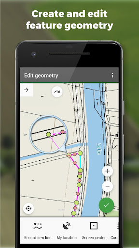
Fieldwork
• offline collecting and updating of field data
• saving points with current or arbitrary position
• creating lines and polygons by motion recording
• settings of attributes
• photos, video/audio or drawings as attachments
• guidance to points
• collecting location data for polygon/line recording or guidance on a target, even when the app is running in the background
Import/Export
• importing and editing ESRI SHP files
• exporting data to ESRI SHP or CSV files
• exporting whole projects to QGIS
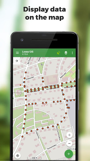
Maps
• wide range of maps both for online use and for download
• support of WMS sources
• support of offline maps in MBTiles, SQLite, MapsForge, TAR, GEMF, RMAP formats, and custom OpenStreetMap data or map themes
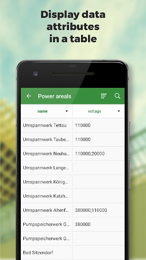
Tools and features
• measuring distances and areas
• searching and filtering of data in the attribute table
• style editing and text labels
• organizing data into layers and projects
Locus GIS is successfully used in a wide range of industries:
• collection of environmental data (ecological scanning, tree surveys ...)
• forestry management and planning,
• agriculture and soil management
• gas and energy distribution
• planning and construction of wind farms
• exploration of mining fields and location of wells
• survey and management of urban facilities
• road constructions and maintenance


Recent Updates - Version 1.19.3
- - chg: option to set 'Not specified' value as the default for an enumeration attribute
- fix: defunct change of a text attribute type to enumeration
Install On Your Mobile Device:


Install On Windows PC Or Mac: